City of Deerfield Beach, GIS/ADA Sidewalk Compliance
Asset Management
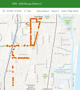
Under our contract with the City of Deerfield Beach, CPC assessed 390 Pedestrians/sidewalks and level of compliance with ADA and deficient ramps. CPC identified all properties and rights of way owned/maintained by the City of Deerfield Beach in the desired location. This process was completed through online research and coordination meetings with the city’s GIS Director.
CPC developed a phasing plan for the fieldwork effort and identified the priority locations based on existing complaints to the city. CPC utilized “Survey123” software (an ESRI) product to develop the data collection pattern with feedback from the GIS Director. The main subject of the collection was to identify any unique identifiers, taking photos, GPS location, landings, slopes, and detectable mats. Executing a field data collection plan, multiple teams of one person were mobile and equipped with a tablet running Survey123. For fieldwork, the system can run on a wireless device that has internet access. These tablets were networked and provided “live” information back to the city’s GIS data center daily. The data obtained on the field is entered and sent directly to the City GIS data base and CPC database simultaneously.
PROJECT NAME: City of Deerfield Beach, GIS/ADA Sidewalk Compliance
CLIENT: City of Deerfield Beach
SERVICES PROVIDED: Geomatics

